Another One Bites the Dust – Swamping the Myth of Groundwater Recharge
Groundwater Can Travel for Hundreds of Kilometers in Vast Networks
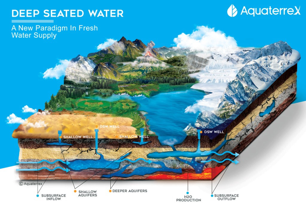
In this era of droughts and water crises across the planet, it’s high time we began to understand the true characteristics of one of our most precious resources. Groundwater constitutes 99% of the world’s unfrozen fresh water and provides drinking water to 145 million Americans and billions of others around the world. It irrigates 60% of agriculture worldwide. Yet, until recently most experts believed that groundwater is recharged (replenished) based on the local surface drainage area. In fact, deep groundwater reservoirs, recharge systems, and subsurface flow paths operate on scales much larger than the surface drainage basin—potentially spanning hundreds to thousands of kilometers.
In a recent study published in January 2025, researchers from Princeton University and the University of Arizona1 created a simulation that maps underground water on a continental scale.
In addition to confirming the concept of “mega watersheds” (also known as aquifer systems and transboundary aquifers), the study also found that deep groundwater from aquifers up to 100 meters (328 feet) deep contributed more than half of the baseflow in 56% of the basins.
Why Is This Important?
The fact is, in many instances there is far more groundwater available than is commonly believed. AquaterreX specializes in locating groundwater, including both shallow and Deep Seated Water, that has been overlooked. Studies like this one can serve as a wake-up call to those who require this important resource.
A Better Way Forward
Fortunately, a better way exists. AquaterreX, a U.S.-based company, employs 21st-century technology to locate groundwater with precision and certainty. By combining advanced computer algorithms, multicomponent geospatial analysis, satellite imagery, and patented instrumentation, AquaterreX has achieved an unparalleled record:
- 100% success rate in locating groundwater in recent projects.
- The ability to determine not just the location of water, but also its depth, thickness of the water-bearing layers, and estimated flow rate.
- Optional instrumentation to measure salinity—crucial for regions where water quality is as critical as water quantity
To date, AquaterreX technology has been used to locate more than 1,500 wells across four continents, bringing water security to farmers, municipalities, and communities that once thought their land was dry.
Moving Beyond Dependence on Weather
The message is clear: we don’t need to remain at the mercy of weather patterns, dwindling aquifers, or outdated analysis. Just as technology has transformed medicine, transportation, and communication, it can transform our approach to water. With proven tools and guaranteed results, AquaterreX is showing the world that water security is possible—today.
Learn more about how AquaterreX is solving water scarcity at www.aquaterrex.com