
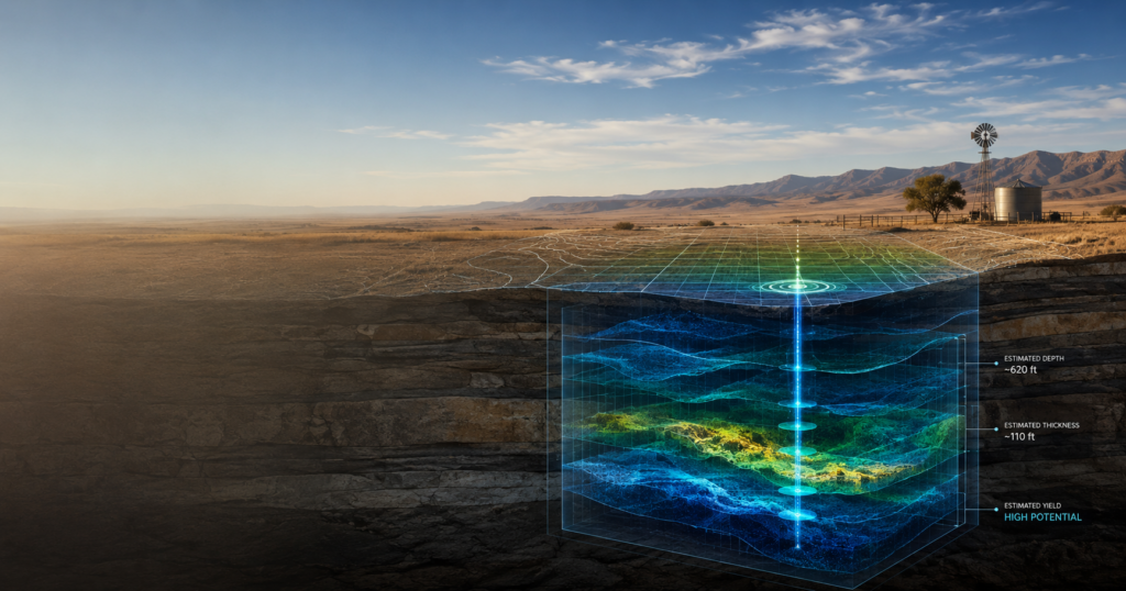
Phase II Groundwater Exploration: Creating a “Virtual Well” Before You Drill
Drilling a water well can represent a substantial investment. Yet conventional well development often begins with a fundamental uncertainty:
What will we actually find when we drill?
How deep will the water be? How thick is the water-bearing formation? What kind of production might the well provide? And is this really the best location on the property to drill?
AquaterreX Phase II Groundwater Exploration is designed to answer as many of those questions as possible before the drilling rig arrives.
Using a combination of geology, hydrogeology and advanced patented geophysical instrumentation, AquaterreX investigates the subsurface and develops what we call a “Virtual Well”—a scientific interpretation of what we expect a wellbore to encounter at a specific location.
The objective is straightforward:
Know more before you drill.
Phase I Finds the Target Area. Phase II Finds the Well Location.
AquaterreX groundwater exploration begins with Phase I.
During Phase I, our geoscientists analyze multiple layers of geological, geophysical, hydrological, topographic, satellite and historical well information to evaluate a property and identify promising Areas of Interest (AOIs) for groundwater exploration.
Phase II takes those findings into the field.
An AquaterreX field team conducts detailed on-site investigations within the selected AOIs using multiple patented geophysical technologies.
Rather than relying upon a single measurement, our scientists examine the subsurface using complementary technologies that measure different physical characteristics of underground formations.
The objective is to progressively narrow the search:
Property → Area of Interest → Target Zone → Recommended Well Location → Virtual Well
What Is an AquaterreX Virtual Well?
A Virtual Well is our interpretation of what a future wellbore is expected to encounter beneath a specific drilling location.
Our Phase II investigation can provide information about:
- The recommended drilling location
- Expected depth to groundwater targets
- Potential water-bearing zones
- Approximate thickness of those zones
- Geological characteristics of the subsurface
- Estimated potential water production
- Indications of water quality or salinity where supported by the data
In effect, we are creating a subsurface picture of the proposed well before physically drilling it.
That does not mean a Virtual Well replaces an actual test well. Only drilling and appropriate well testing can physically confirm the formations encountered and determine sustainable production.
But it can give the customer considerably more information about what to expect before committing to an expensive drilling program.
How Do We See Hundreds of Feet Underground?
We don’t literally see underground. Instead, our patented instrumentation measures physical responses associated with subsurface geological and hydrogeological conditions.
Different geological materials—and formations containing groundwater—can exhibit different physical characteristics.
AquaterreX uses multiple forms of geophysical investigation so that one dataset can be compared with another. These measurements can help identify changes in geology, potentially permeable formations, subsurface anomalies and potential water-bearing zones.
Our geoscientists are particularly interested in places where multiple independent measurements converge on the same interpretation.
This concept of data convergence is fundamental to Phase II.
One measurement may indicate an interesting anomaly. Several independent measurements identifying favorable conditions at approximately the same location and depth provide a much stronger basis for selecting a drilling target.
Building a Three-Dimensional Picture
The Phase II process begins with systematic field measurements across selected portions of an Area of Interest.
Instead of taking a few isolated readings, our scientists collect measurements across a planned survey area. The initial results help identify subsurface anomalies and geological features that deserve closer investigation.
Additional measurements can then be concentrated around the most promising locations.
The field data is subsequently processed and interpreted to create two-dimensional profiles and three-dimensional models of subsurface conditions.
These models help our geologists and hydrogeologists visualize changes beneath the property and identify formations that may provide pathways or storage zones for groundwater.
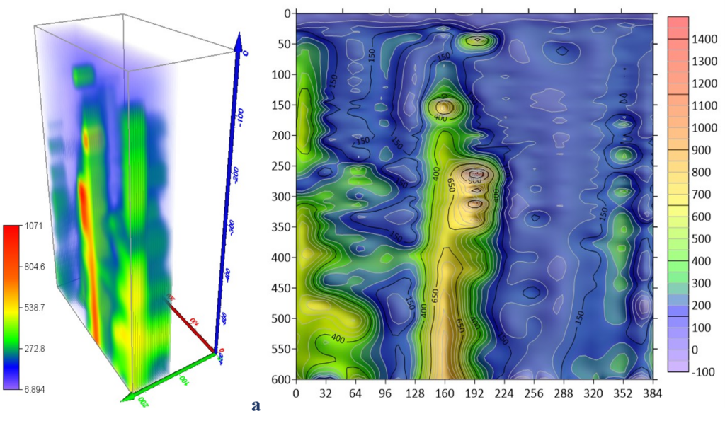
Example of a three-dimensional subsurface interpretation developed during a Phase II investigation. The purpose of these models is to help AquaterreX geoscientists identify geological variations and potential groundwater targets.
Ground Truthing: Comparing the Virtual World with the Real World
An important component of Phase II is ground truthing.
Where reliable existing wells are available, AquaterreX can conduct measurements near known wells and compare our geophysical interpretation with actual drilling information.
Existing well logs may tell us:
- Actual well depth
- Geological formations encountered
- Depth to water
- Screened intervals
- Historical production
- Changes in groundwater levels
That information provides a valuable reference for interpreting measurements elsewhere on the property.
The Phase II report, for example, describes calibration measurements conducted near an existing water well before interpretations were finalized.
Multiple Technologies—One Integrated Interpretation
One of the important differences in the AquaterreX approach is that we do not depend upon one geophysical technology to make a drilling recommendation.
Our Phase II investigations employ multiple patented scientific instruments, each providing a different perspective on subsurface conditions.
We intentionally do not publicly disclose all of the equipment configurations, proprietary software, algorithms or analytical procedures involved in the process.
What matters to the customer is the result.
Each dataset is processed and evaluated by AquaterreX geologists and hydrogeologists. The results are then compared with:
- Known geology
- Existing well information
- Geological and hydrogeological maps
- Phase I findings
- Field observations
- Other independent geophysical measurements
This integrated analysis enables us to develop the Virtual Well and identify specific locations considered favorable for drilling.
From Hundreds of Measurements to One Drilling Decision
A Phase II investigation can generate a substantial amount of field data.
In the project illustrated here, for example, the AquaterreX field team conducted 309 subsurface soundings over six days, followed by approximately 60 hours of data analysis to evaluate the Areas of Interest and identify the strongest indications of deeper aquifers.
That illustrates an important point about modern groundwater exploration.
The customer does not need hundreds of measurements.
The customer ultimately needs an answer to a much simpler question:
Where should we drill?
The purpose of collecting and analyzing all of that information is to reduce a large property to specific drilling targets supported by multiple lines of scientific evidence.
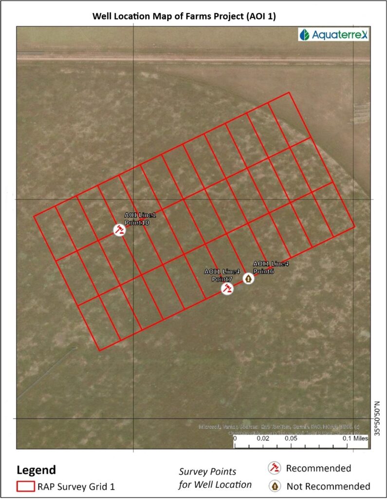
Example of a Phase II field investigation in which systematic subsurface measurements are progressively evaluated to identify potential drilling locations.
What Does the Customer Receive?
At the conclusion of Phase II, AquaterreX can recommend specific drilling locations and provide the customer with our interpretation of what may be encountered in the wellbore.
Depending upon the project and quality of the available data, the Virtual Well may include estimates of:
Location → Target Depth → Water-Bearing Zones → Aquifer Thickness → Potential Yield → Water Characteristics
This is fundamentally different from simply saying:
“There may be groundwater somewhere in this area.”
We are attempting to tell the customer:
“Based upon multiple independent scientific measurements, this is where we recommend drilling, this is approximately how deep we expect the target to be, and this is what we expect the wellbore to encounter.”
Reducing the Risk of an Expensive Dry or Poor-Producing Well
No groundwater exploration technology can eliminate drilling risk.
The Earth is heterogeneous, and subsurface conditions can change over relatively short distances. Estimated depths and production rates are therefore interpretations—not guarantees.
The final confirmation comes from drilling.
Once a well is drilled, proper development and pumping tests are necessary to determine actual and sustainable production. The Phase II report makes this distinction explicitly: test drilling is recommended to verify hydrogeological potential, and sustainable yield can only be determined through proper testing during and after the drilling process.
The purpose of Phase II is therefore not to eliminate the need for drilling.
It is to make drilling a much better-informed decision.
From Exploration to Water Security
For agriculture, municipalities, industry, data centers and other major water users, groundwater is more than a natural resource. It can be a critical long-term asset.
And as drilling becomes deeper and more expensive, knowing where to drill becomes increasingly valuable.
AquaterreX combines:
Phase I — Remote scientific investigation and identification of promising Areas of Interest
Phase II — On-site investigation using patented geophysical instrumentation
Virtual Well — Prediction of what a proposed wellbore is expected to encounter
Drilling & Testing — Physical confirmation and determination of sustainable production
The result is a fundamentally different approach to groundwater development.
Instead of beginning with the drilling rig and hoping for the best, we begin with science.
Know Before You Drill.
That is the purpose of the AquaterreX Virtual Well.