
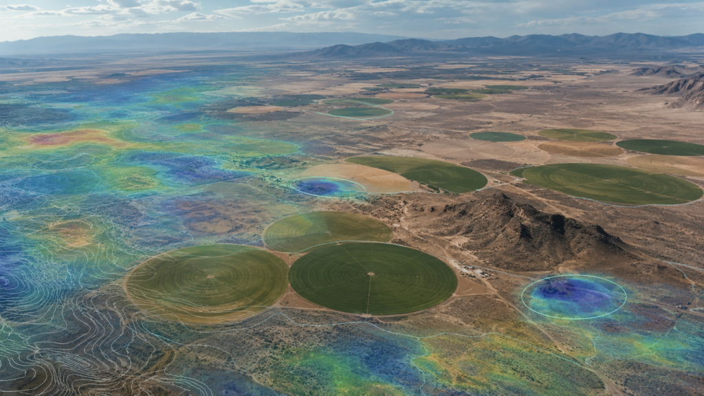
Finding Groundwater Before Drilling: The Science Behind AquaterreX Phase I Analysis
How multiple layers of geoscientific data can reduce the uncertainty and cost of groundwater exploration
Drilling a water well has always involved uncertainty.
Even in regions known to contain significant groundwater resources, conditions underground can change considerably over relatively short distances. One well may produce substantial quantities of water while another nearby well may produce very little.
For agriculture, real estate development, industry, municipalities, data centers and other large water users, that uncertainty can become expensive very quickly.
AquaterreX was developed around a different approach:
Learn as much as possible about the geology and groundwater potential of a property before drilling begins.
Our Phase I Groundwater Resource Assessment uses advanced geoscientific information to evaluate a property and identify areas that warrant more detailed groundwater investigation.
The objective is not to simply pick a drilling location from a map or image.
It is to identify the areas where the total body of scientific evidence indicates that favorable groundwater conditions may exist.
Groundwater Exploration Is a Geological Problem
Groundwater is often misunderstood.
It usually does not exist as a large underground lake waiting to be tapped. Depending on the geological environment, groundwater may be stored or transmitted through porous rock, sand and gravel deposits, fractures, faults, weathered zones, buried channels and other subsurface structures.
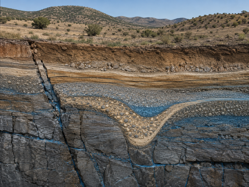
That means finding groundwater requires understanding the geology that controls where water can accumulate and how it can move.
This is the foundation of the AquaterreX Phase I methodology.
Our hydrogeologists examine a property within its broader geological and hydrological setting and evaluate multiple independent sources of scientific information for evidence of conditions favorable to groundwater.
The Phase I work is performed remotely using advanced geospatial and geoscientific data. Areas identified during Phase I can then be investigated more precisely through an on-site Phase II field survey.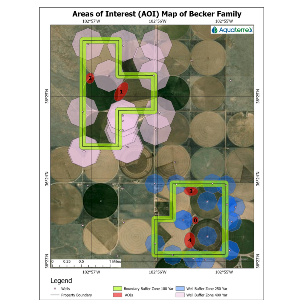
Multiple Sources of Scientific Information
One of the strengths of the AquaterreX approach is that groundwater potential is not evaluated using a single map, image or source of information.
Depending upon the property, location and availability of data, our scientists may examine a combination of:
- Remote sensing and aerial information
- Terrain and surface characteristics
- Geological and hydrogeological information
- Subsurface geoscientific data
- Existing groundwater and water-well records
- Maps, reports and scientific information from recognized sources
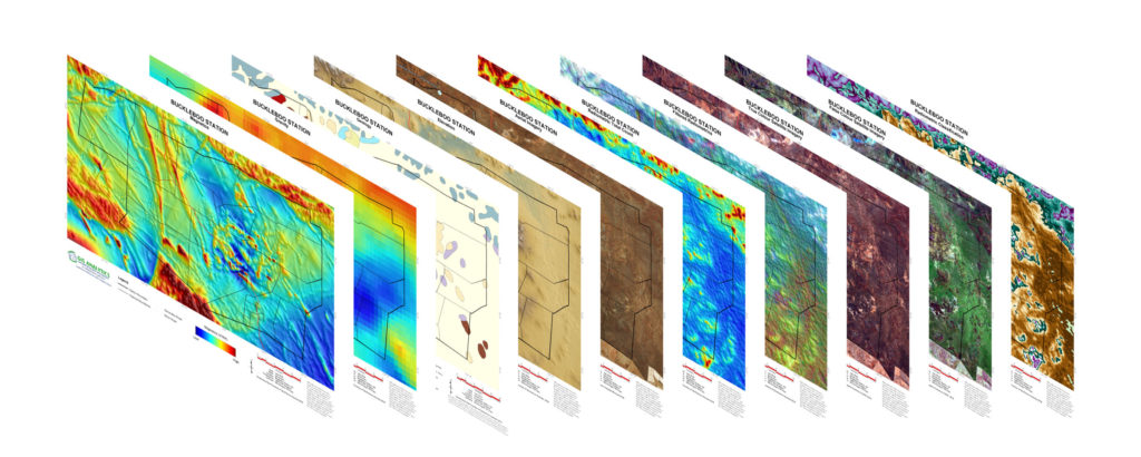
Each source provides a different perspective on the property and its geological setting.
The value comes from integrating those independent sources into a broader scientific interpretation.
Why Multiple Sources Matter
One of the most important principles behind the AquaterreX approach is that no single dataset is treated as definitive proof of groundwater.
No single image, map, measurement or neighboring well can tell us everything we need to know.
Each provides a different piece of information about the surface or subsurface environment.
The real value comes from examining the relationships among these different types of information.
For example, a geological feature identified in one source may become more significant when related patterns appear in other independent scientific information.
Likewise, surface characteristics may become more meaningful when they correspond with geological structures, drainage features or known groundwater conditions.
The Phase I assessment integrates and concurrently analyzes multiple sources of information to identify locations where several indicators of groundwater potential occur together.
This concept—convergence of evidence—is central to our work.
The Importance of Geological Lineaments
Among the many features examined by groundwater scientists are lineaments.
A lineament is a linear or semi-linear feature visible in the landscape that may represent an underlying geological structure, such as a fracture or fault.
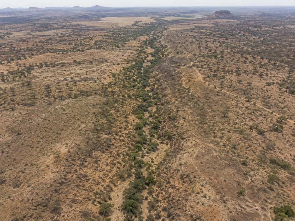
These features can be important because fractures and fault systems may influence the movement and storage of groundwater.
However, the presence of a lineament alone does not establish that a productive groundwater resource exists.
Its significance must be evaluated in the context of the surrounding geology and the other available information.
Again, this illustrates why groundwater exploration should rely on multiple lines of evidence rather than a single observation.
Remote Data Provides Clues—Not X-Ray Vision
Remote sensing has become an increasingly powerful tool for groundwater exploration, but it is important to understand what it can and cannot do.
Remote technologies do not simply photograph an underground reservoir.
Instead, they provide information about surface and geological characteristics that may offer indirect clues about conditions underground.
Those clues can be valuable.
But AquaterreX does not treat them in isolation.
They are evaluated as part of a much broader geological and hydrogeological interpretation.
Geoscientific Data Helps Us Understand What Lies Beneath
Other forms of geoscientific information can provide additional perspective on subsurface conditions over large areas.
AquaterreX scientists use appropriate available data to help evaluate the geological framework of a property and identify structures or conditions that may be relevant to groundwater exploration.
Importantly, these datasets should not be interpreted as direct pictures of groundwater.
They provide scientific evidence that must be interpreted in relation to the geology, topography and other available information.
It is the integration of those different sources—not any individual dataset—that provides the foundation for the Phase I assessment.
Existing Wells Add Real-World Evidence
Historical drilling information is another important part of understanding groundwater potential.
Registered well records may provide information concerning:
- how deep nearby wells were drilled,
- where water was encountered,
- reported water levels,
- reported production rates, and
- which aquifers or formations were used.
This information provides valuable context.
But even a productive neighboring well does not guarantee the same result at another location.
Geology can change.
That is why well records are most useful when interpreted alongside the broader geological and scientific evidence.
From a Large Property to Areas Worth Investigating
One of the principal outputs of Phase I is the identification of Areas of Interest, or AOIs.
An AOI is not necessarily an exact drilling location.
It is an area where AquaterreX’s hydrogeological assessment indicates that the evidence is sufficiently encouraging to justify more detailed investigation.
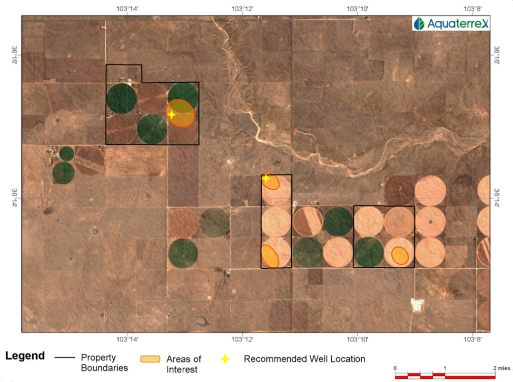
These recommended AOIs are a key deliverable of the geospatial assessment and identify locations where subsequent groundwater exploration and well-location work should be concentrated.
That is an important distinction.
Rather than approaching an entire property with equal uncertainty, Phase I allows the exploration effort to focus on selected portions of the property.
This can significantly improve the efficiency of the next stage of investigation.
Phase II: Moving From Remote Analysis to the Field
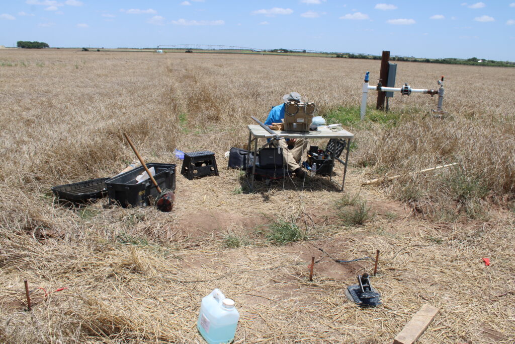
Once the most promising areas have been identified, AquaterreX can move to Phase II, where on-site measurements and observations are conducted.
The purpose of Phase II is to validate and refine the remote assessment and obtain substantially greater detail about subsurface conditions.
Field investigation can help determine characteristics such as the location, depth and thickness of potentially water-bearing zones. The resulting information can also contribute to three-dimensional interpretations of the subsurface and the selection of more precise potential well locations.
The important principle is simple:
Phase I determines where we should investigate.
Phase II determines where we should drill.
Reducing the Risk Before the Drill Rig Arrives
No responsible groundwater exploration company should claim that any remote technique can guarantee a successful well.
The subsurface remains complex, and ultimately a groundwater resource must be confirmed through drilling and testing.
But that does not mean drilling has to begin blindly.
Modern geoscience, remote analysis and extensive scientific information now allow us to understand much more about a property before committing substantial capital to drilling.
That is the purpose of AquaterreX Phase I.
Rather than relying on a single technology, we examine multiple independent sources of scientific evidence and look for locations where those indicators converge.
The goal is straightforward:
Reduce uncertainty. Focus the investigation. Improve the odds of drilling in the right place.
For a landowner, farmer, developer, municipality or industrial water user, that can represent a fundamentally better way to approach groundwater exploration.
Investigate first. Drill second.